Environmental Sensing
Field nodes continuously monitor CO, CO₂ and environmental conditions in high-risk areas.
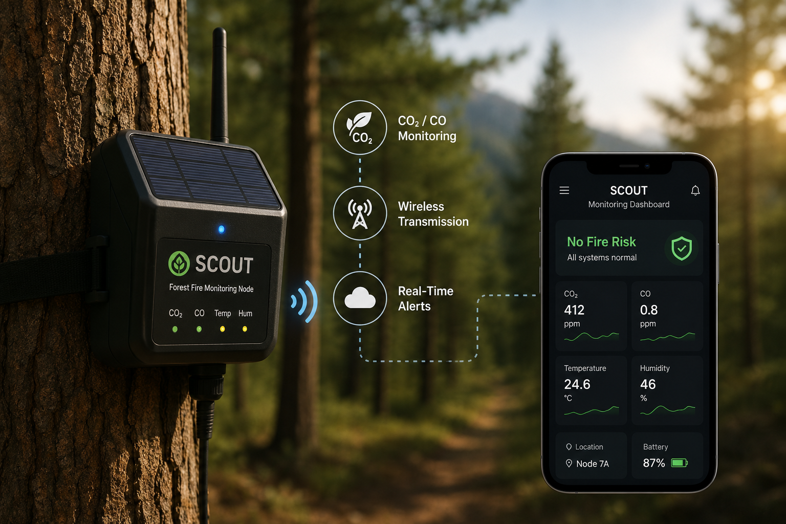
Scout combines distributed environmental sensors, solar-supported field nodes and wireless communication to detect early fire indicators and deliver rapid alerts.

Field nodes continuously monitor CO, CO₂ and environmental conditions in high-risk areas.
Detected anomalies are transmitted through the communication network for rapid verification.
Solar-supported energy architecture helps maintain operation where grid access is limited.
Conventional observation may identify a fire only after smoke or flames become visible. Scout is designed to create an earlier warning path by moving sensing directly into the field.
Fast-spreading fires damage forests, wildlife habitats and biodiversity before response teams arrive.
Severe fires increase erosion and reduce the quality of surrounding soil and water resources.
Smoke and combustion gases create health, visibility and wider environmental risks.
Scout uses distributed field nodes to observe risk conditions, process sensor data and transmit alerts to the monitoring platform.

Installed near trees and risk zones to monitor early environmental changes close to a possible ignition point.
Tracks CO and CO₂ variations that may indicate combustion or abnormal environmental conditions.
Transfers warning data and node information from remote field areas to the monitoring platform.
Presents alerts, location information and operational status for rapid review and intervention planning.
Scout converts continuous sensor readings into a structured warning workflow for field and control teams.
Nodes continuously read gas levels and environmental conditions.
Embedded processing evaluates whether observed changes indicate a fire risk.
The warning is carried through the wireless communication structure.
Responsible teams review the alert and coordinate field verification or intervention.
Multiple Scout nodes can form a distributed monitoring layer across forests, recreation zones, protected areas and infrastructure corridors.
Rapid warning delivery supports faster verification and decision-making.
Each event can be associated with a monitored zone or reporting node.
Reduced dependence on fixed power infrastructure improves remote deployment.
The system can be extended with weather, imaging and additional sensor technologies.
Earlier notification can reduce the time between ignition, verification and field action.
Rapid detection helps prevent a small local fire from expanding into a wider incident.
Protecting forests also helps preserve wildlife, soil stability and surrounding communities.